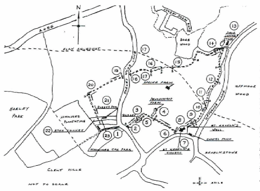
WALKS AROUND HAGLEY: WALK No.6 ST KENELM'S
DISTANCE: 3 MILES TIME ABOUT TWO AND A HALF HOURS. PARK IN NIMMINGS CAR PARK (PARKING CHARGE) (O.S. MAP GRID REF. 938808)
Abbreviations: Compass points = N.E.S.W. ridge and furrow = r & f Directions left or right = L.R. century = c.
- Leave the car park by the vehicle entrance and cross the stile almost immediately opposite.
- Straight ahead, across field, down bank where r & f is visible, shortened now. Perhaps a relic of the medieval open field system of farming. Proceed down field diagonally R. Large quarry on R surrounded by trees. Continue to gate beside a cattle entrance. Muddy in wet weather. Bear R. after the gate, more r & f can be seen.
- Pond on R. continue for short distance then R. again. Meet wide old track to the old Penorchard Farm.
- Make short detour L. down track. On L. note house platforms in field. Beyond are mined l7th.c. sandstone outbuildings. of old Penorchard Farm, perhaps quarried near site. The 1838 Clent Tithe map and schedule shows the owner as John Amphlett and occupier as George Whittaker, with mixed farming. Return up old track to stile.
- Climb stile into field. Cross field noting old track to original farm mid-field; remains of aid gate posts in far hedge. In next field (Chapel field) note house platforms on R. behind church. R & f visible on L.
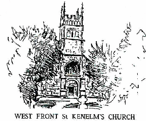
- Over stile into St. Keneims churchyard. Although the church is ancient the first burial in the churchyard was in 1857, earlier burials being in Halesowen.
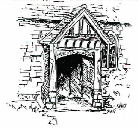
- The church is dedicated to St. Kenelm, a figure surrounded by legend and mystery. Son of Kenuif, King of Mercia 796-821, the 7 year old Prince Kenelm was allegedly killed near this spot at the command of his elder sister Quendryda in an attempt to seize the throne on their father's death. Legend tells us that Kenelm's body was hidden under a Thorn bush by his murderer and discovered only after a mystical appearance to the Pope in Rome of a dove bearing a scroll written in Anglo-Saxon and telling of the murder. This story is mentioned in Chaucer's Canterbury Tales (The Nun's Priest's Tale), and merited a translation of the scroll by John Milton as: "Lo. in a mead of kine, under a thorne; of head bereft, lieth poor Kenelm, King born". When the body was exhumed for reburial at Winchcombe Abbey, legend has it that a spring of pure healing water gushed from the ground. The site became a place of pilgrimage and led not only to the later building of St. Kenelm's church but also the growth of the nearby medieval village of Kenelmstowe (see map). The village declined after the reformation when pilgrims ceased to visit the spring. The present church was started in the 12th. c., enclosing the original spring in its undercroft. Later the water drained away, or was channelled, and emerged lower down the hillside. The church is worth a closer look from the outside. Entrance to the interior is restricted. Approaching from our path (&) you will see the W. Tower c.1475 (grey sandstone), standing forward of the older 12th. c. Norman wall (red sandstone). Note gargoyles at W. Angles and corners of church roof. The NW buttress has a small incised 15th century consecration cross. SW buttress, empty niche once contained a carved figure. Continuing round N. wall, note two blocked-up doorways: central one porch demolished in 1846 restoration, the other was a priest's entrance. Return to main path round S wall: Tudor porch c.1550. Tympaniurn, Norman c.1150, possibly work of Herefordshire school of carvers. Note high on S. wall to E. of porch carving of figure, reputed to be St. Kenelm. Formerly inside the church hence its excellent condition, of early date. A little further to E., the blocked-off doorway which once led down to St. Kenelm's well in the undercroft. A detour can be made to the Lych Gate, erected c. 1919. Along road is Chapel Farm, built 1868 on site of earlier farmhouse.
- Follow path to E end of Church to landscaping of St. Kenelm's spring. The sculptured wooden posts in the area were the result of a collaboration between the N. Worcestershire Countryside Action Project and local school children who designed them. Note also rag-adorned tree lower on L near an alternative spring in bank. Presumably a modern version of medieval custom at healing springs such as St. Kenelms. Pilgrims seeking healing would hang their bandages, on a nearby tree before bathing the affected part, hoping for a cure by the time the bandages disintegrated.
- Our path follows the L hand bank of a deeply cut stream which starts from the well, joined by other springs, and other streams lower down. This forms one source of the River Stour. Through 2 gates note information board on Penorchard Meadows Nature Reserve. R & f visible L hedge at top field may be old open field boundary. Pass into next field.
- Note small concrete entrance to culvert R which carries stream under Elan Valley pipe line aqueduct.
- Aqueduct itself crosses a short distance downstream, carrying water from Wales to Birmingham. Note sturdy iron railings. Stables and road on R a few yards below, stream emerges from its culvert under the aqueduct. Pass over stile now used as a fingerpost then through gate in hedge. Follow hedge on R. r & f in field L road on R. Uffmoor Wood beyond that.
- Follow meandering path through woodland. Bogs Wood visible on L. Cross stream R barbed wire fence L note hurdle horse shelter R.
- Field Cottage Farm on R. Look back for pleasant view just walked.
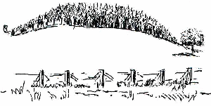 Bridle path. Our way is L, ignoring the arrows invitation to go R after a few yards. Good view of Clent.r & f both sides of track. After short distance turn onto narrow fenced path to skirt Bogs Wood. 2 stiles.
- Bank on R is spoil heap of Elan Valley pipe line. Through kissing gate and follow path through to next field. Follow R hand hedge r & f visible near edge of field on L. Over stile L.
- Skirt R edge of field. R & f both sides. Go through gap in holly hedge and through 1 kissing gate. Note late r & f going down to the main road (broader than seen previously). These fields on R are part of the eastern-most edge of Hagley Parish. Continue on, keeping to lower edge of field.
- Waterworks buildings can be seen up on L, down on R.
- Over stile. Cross over Hagley Wood Lane, through gate opening.
- Skirt Hagley Wood, mentioned in Doomsday survey 1086 as being half a mile long and 3 furlongs wide. Note view of Clent on skyline L. Ignore the first stile on L but cross the second on L., marked with warning to keep dogs under control.
- Up steep field. Through kissing gate.
- Pause to look at Nature Reserve created round old farm pond (or possibly old quarry site) L sheltered spot with seats and explanatory board re Robbo's Pool. Continue climbing.
- Note board explaining "Stu's Spinney". Through kissing gate.
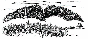
- Up more slope and through gate into Nimmings Car Park, Turn and look NW for view over Wychbury Hill (site of an Iron Age hill fort) and the 18th. century obelisk.
 1
1
