WALKS AROUND HAGLEY: WALK No.3 CHURCHILL
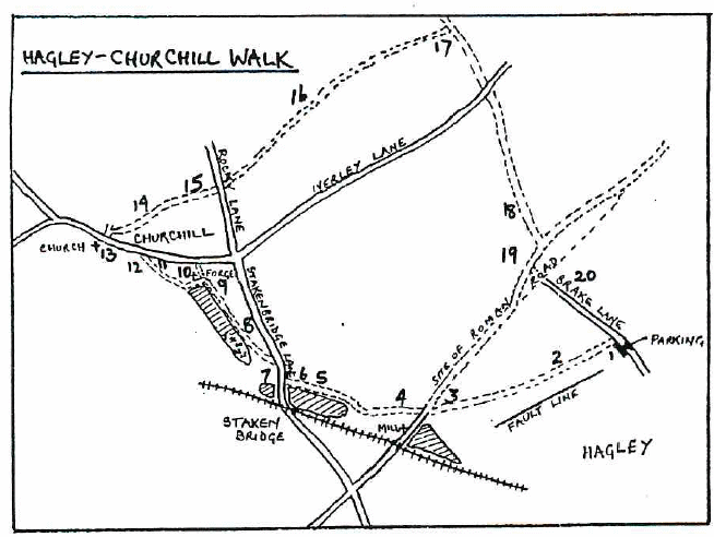
DISTANCE APPROX. 3 MILES. TIME 2 HOURS. PARK IN BRAKE LANE ON PULL IN (O.S. MAP GRID REF. 894806)
Diversions add time and mileage.
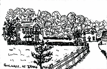
- Turn left into the path next to "Chimneys", between double hedges. The width is 15ft. as in the tithe Award of 1938.
- As the path reaches the open field, once divided by a hedge going up from the gate, on the right you can see Brake Mill Plantation. The steep dip in the field to the left is a geological fault. A better view is obtained by diverting to the L. on the path by the farm, as far as the stile.

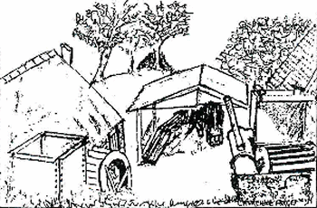
- The Miller's cottage on the R. and the farmhouse on the L. were built by the Railway Company c.l850 because the original cottage and farmhouse were destroyed when the railway was constructed. The path to the L. of the cottage, as you face it, is on the route of the Roman Road connecting Droitwich with Greensforge and Watling Street.
Diversion A
A short walk down the tarmac drive gives a close look at Brake Mill and the Pool, separated by the Dam. Sweetpool and Brakemill Pool were made in 1543. - Return to the farm and take the path to the left behind it to Stakenbridge, following the Wannerton Brook along the valley. From this path you can see the rear of Brake Mill, the tail race and, if you look very carefully, you can see some brickwork in the bank of the stream which is, presumably, the ruins of the cellar of an earlier house marked on the Churchill tithe map.
- Walking past the marshy ground where the stream and tail race meet you continue on to Stakenbridge Pool, described as the "New Poole" in 1589. In 1994 new paths and boardwalks were made round the pool.
- To your right is Stakenbridge Farm, converted c.l987. In 1940 Kelly's Worcestershire Directory it is described as Stakenbridge Riding School run by Capt. Rupert Bache.

- Once over the stile, cross the road. A little to the left are a few remains of Stakenbridge Forge, a Spade and Shovel Works, which ceased working after the second World War. Traces of a sluice and some brickwork are still visible but a recent pool covers the site.
- Turn back past Stakenbridge Farm then fork left onto the path to Churchill. On the rise to the right is Churchifi House. The original part was built in 1740 for the Estate Manager to Sir Thomas Lyttelton.
- On the left of the path is Churchill Pool. The path skirts the edge of it through the kissing gate by the overflow sluice, then over the low stile and turn left unless diverting.
Diversion B
Continue straight ahead to Churchill Lane, then turn right and walk to the crossroads. There one can see: (i) The War Memorial (on the left) (ii) Churchill School on the crossroads built 1895 closed 1961 and now a private house. (iii) The Village Hall, next door, which was built as Churchill's school c.1798. (iv) The Pound is to the right, on the left side of Stakenbridge Lane, it was erected in 1862. Return to the low stile and turn right. - On the dam you can see the sluice to the forge and to the right is a good bird's eye view of the forge itself and an explanatory notice.
- Continue along the dam, then turn right between the house and the cottages. The path has fencing on the left and the stream and tail race on the right which join at the modern bridge. You cross the stile and the old bridge to Churchill Lane.
- On the left is Bridge Cottage first part built in 1730, the second cottage, built later sideways to the first. It was once a Cider House and is shown on the Tithe Map of 1838.

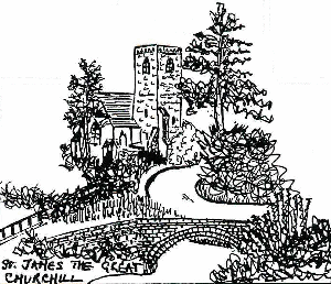
- Ahead is a good view of the Church of St. James the Great. It was built In 1868 to replace a thirteenth century (with later additions) church
- Turn right opposite the church, past the barn conversions, Old Church Farm House is on your left. Cross over the second stile on the left then diagonally across the field, called "Backside" on the Tithe Map, (Possible ridge and furrow) heading up the slope for the conifer on the left to find the next stile. As you climb look back at the excellent views of Churchill and Harborough Hill.
- Cross the stile and you are in "Crab Tree Close", then "Cooks Furlong" before reaching the remains of the double hedge. This divides "Shoulder of Mutton" and "Poole Piece" from "Parsons Field" which is behind Glebe House, once the Rectory. All these fields were in "Churchill Field" which was one of the three Common Fields of the Middle Ages, the other two being "Whitnell" and "Neyther".
- Cross Rocky Lane and follow the path at the edge of the field onto the ridge, where there are splendid views. First on the right views of Wychbury, Clent, Walton and Lickey Hills. Further along a glimpse of St. John's Church, Hagley and Hagley Hall. Look left to see ( from left to right) the Clee Hills, Kinver Church and further over, on a clear day, the Wrekin.
- On reaching the North Worcestershire path (marked on posts) turn right, downhill to Iverley Lane. The farm to the right is Common Farm which was established soon after the common land was enclosed in 1774.
- Cross Iverley Lane and follow the path that is the unmetalled part of Brake Lane. Notice the width between the hedges, (30ft). This was because It was designated a public carriage way in the Enclosure Award, possibly an alternative route to Stourbridge.
- Just past the lowest point of the lane you can see the remains of a brick wall in the undergrowth on the right. On the Hagley Tithe Map of 1838 four houses and gardens are shown here.
- In the field on the right is some brickwork known locally as "The Butts" because shooting was practised here by the Home Guard during the Second World War.
- On reaching the 'T' junction turn right and shortly turn left and continue along Brake Lane to your starting point. On your right as you go is Palmers Hill and the farm to the left is Upper Brake Farm which is a Victorian building marked on the 1884 O.S. This is on land enclosed in 1832 but the farm dates from the 1860's because the field next to the lane was not sold to the Lytteltons until then.
 1
1
