WALKS AROUND HAGLEY: WALK No.2 WASSELL GROVE
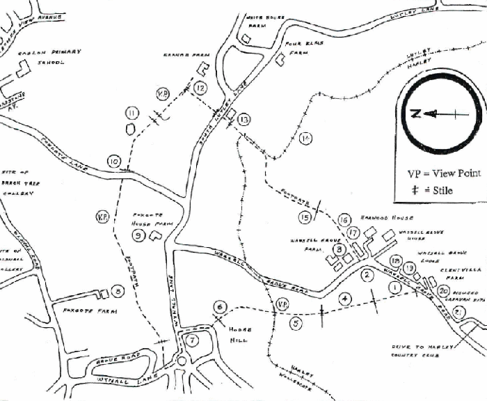
DISTANCE: APPROXIMATELY TWO & A HALF MILES. TIME: ONE & A HALF HOURS. PARK ON WASSELL GROVE ROAD BETWEEN THE COUNTRY CLUB AND THE FOOTPATH (O.S. MAP GRID REF. 932823)
N.B. A compass is useful. Bare legs not recommended.
- From Wassell Grove Lane cross stile and take footpath diagonally across the field (NOT along the hedge). Just inside the field are two house platforms, the "Tenement" shown on the 1837/8 Tithe Map. (Note: references to platforms etc. depend on grass being cropped.)
- Remains of pond possibly associated with farmhouse. Ridge and furrow visible.

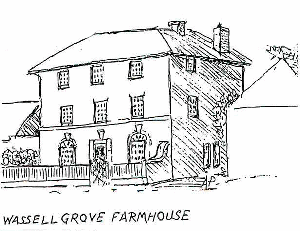
- Wassell Grove Farm. Grade II listed building. Brickwork shows top storey added later. 18th. century possibly altered early 19th. century. Barn dated 1826.
- More ridge and furrow. Pond and dried up stream. Old hedge.
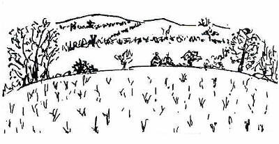
- View Point: Rowley Hills E., Leasowes E., Frankley Beeches S.E., Dudley Castle and Top Church E.N.E.
- Steps mark geological fault line and also the parish boundary between Hagley and Wollescote.
- Enter Council Estate built 1931 by Lye - Wollescote U.D.C. via Ashfield Crescent to Wynall Lane. Leave shops on your left at island. Footpath on R. opposite Sensall Road, signposted Lutley.
- Foxcote Farm on L. Farmhouse c.1900.
- Foxcote House Farm R. Grade II listed building, model example of a Georgian farm complex c.1794. Note blocked-in windows presumably because of window tax. (1696-1851) View Point: Oldnall and Beechtree Collieries N. near Oldnall Road, Caslon Wood and Primary School N.E.
- Cross Foxcote Lane and over stile down fore draft. Note evidence of coppicing hazel nuts.
- Foxcote Pond. Mentioned in Anglo-Saxon Charter. Boundaries of Lutley, Cradley and Oldswinford all met nearby. Ridge and furrow visible. Balk on mid-slope indicates division of two main blocks of medieval Open Field System. Mesolithic flints found here and in vicinity.

- Cross over stile on R. Grange Farm on L. Possible house platform(s) in field.
- Cross road to Grange Farm Cottage. Follow public footpath at side, Part of hedge marks Hagley Lutley border.
- Modern fishponds visible through chain link fence on L. as the path turns W. towards (15)
- Old hedge, including field maple. Stile. Entrance driveway to modern fishponds on L.
- Wall skirts Wassell Grove House estate. Old house (Georgian with large Victorian extension) now replaced by two modern ones. Brick walled garden. At end of 18th. century Wassell Grove House was the residence of Daniel Rogers. Later owned (together with a great deal of the surrounding land) by John Richards, High Sheriff of Worcestershire 1844. Latter part of 19th. century owned by Job Garrett J.P. During First World War administered by Birmingham Board of Guardians as Convalescent Home. Bought 1958 by the builders who demolished the old House and built two modern ones.
- Stable block of old Wassell Grove House converted to modem mews dwellings. Dovecote in roof apex retained. Stables used to house a theatre c.100 years ago, when owned by the Garrett family. (Close-up view of farmhouse, No.3 above, shows some alterations made since it was first built, Closer view of dried-up pond on opposite corner, No 2 above.)

- Old stone wall on L. probably pre-dates the Georgian Wassell Grove House. Remains of foundations were found by the builders when constructing the driveways to the two modem houses. The entrance drive lower down the lane is of fairly recent construction although it reuses the old stone blocks. The old wall of similar stone on the R. has a brick infill at a point which may mark the entrance to the old tenement (No.1 above), the platform of which was noted at the start.
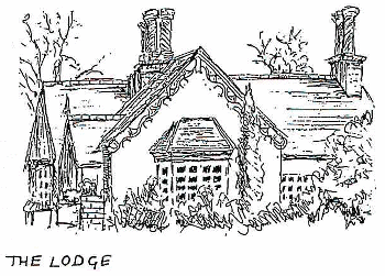
- The Lodge, situated at the former entrance to Wassell Grove House, is of cottage ornne style, not marked on the Tithe Map of 1837, probably mid-19th.century built rather late for the style.
- Clent Villa Farm 18th century with later additions.
- Near entrance to Hagley Country Club is site of mobile home complex existing until 1960's - early 1970's when the Club was opened.
 1
1
